Renew your membership today and help protect the future of our nation’s cold, clean, fishable water. Together, we can preserve the thrill of chasing wild fish in wild rivers.
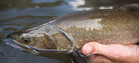
We found riparian exclosures in the Goose Creek Group Allotment to benefit woody riparian vegetation but not all aquatic biota that are typically influenced by watershed-scale factors. Thus, riparian exclosures should be one of several grazing management tools implemented simultaneously to promote and improve stream health at larger scales relevant to most aquatic biota in the presence of livestock grazing.
Photos from before (Top; 1988) and after (Bottom; 2011) installation of a riparian exclosure (GOCR) on Goose Creek, Cassia County, Idaho. Photo credits: Burley Field Office, BLM. (Click photos to enlarge)
Map of Goose Creek Group Allotment, study exclosures, and field survey sites sampled for riparian and instream habitat, aquatic macroinvertebrates, and fish in 2015. Only perimeters from fires since 2000 shown. (Click to enlarge)
Mean (±1 SE; n=4) Landsat NDVI over time by exclosure treatment (inside ●, outside ●) for each exclosure. Vertical line indicates when exclosure was built; LCLD exclosure was built in 1982. Years fire expected to influence NDVI values at some or all sites per exclosure indicated at top (▅), typically two years post fire (see Figure 1). Annual precipitation during water year shown in bottom right panel. (Click to enlarge)
Mean (1 SE) scores from a benthic macroinvertebrate multimetric index by exclosure treatment (inside, outside) for each exclosure in the Goose Creek allotment. 50th and 10th percentile scores of reference sites in the Plateaus, Plains, and Broad Valleys region are shown for context. (Click to enlarge)
Aerial imagery of Upper Cold Creek Exclosure. (Click to enlarge)
Aerial imagery of the Lower Cold Creek exclosure in the Goose Creek watershed. (Click to enlarge)
Aerial imagery of Emery Creek exclosure. (Click to enlarge)
Aerial imagery of Goose Creek exclosure. (Click to enlarge)
Aerial imagery of Coal Banks exclosure. (Click to enlarge)
Aerial imagery of Stateline exclosure. (Click to enlarge)
Aerial imagery of Little Birch Creek (east) exclosure. (Click to enlarge)
Aerial imagery of Little Birch Creek (west) exclosure. (Click to enlarge)