Location: Southwest Montana
Type of stream: Freestone
Angling methods Fly, Spin
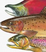
Species: Rainbow, Browns, Cutthroats
Access Easy
Season: Montana all year, Yellowstone: Saturday of Memorial Day weekend through 1st Saturday of Nov. Supporting
Services: Big Sky
Short take: A river of scenery and solitude
Handicapped access: Yes
Closest TU Chapter: Madison-Gallatin
Headed for Yellowstone in July but leery of crowds on the park’s streams? Set your GPS for West Yellowstone. About four miles north US 191 enters the park and then leaves it quickly as it crosses the Gallatin River. East of the bridge, the river climbs up a gentle valley beneath 10,000 foot peaks for more than 20 miles to its headwaters in the Gallatin Lakes. So shallow you’ll rarely wet your knees, the river is essentially one long riffle. Banks are often undercut. Every little pocket may hold a trout. Typically, rainbows range between 10 and 12 inches. Browns may reach 15 inches. Take the Bighorn Pass trail up the valley.
As the river leaves the park, its valley narrows. At times it crashes through steep-sided canyons which give way small flood plain meadows. Three miles north of the park boundary, water from Taylor’s Fork doubles the size of the Gallatin. Big plunge pools, heavy runs, and pocket water characterize high gradient sections of the river. Handicapped access platforms, created with help from the Madison Gallatin chapter of TU and others, are located at Deer Creek Trailhead and Moose Creek Flat Campground.
The river holds something for anglers of all skill levels: from the greenest novice who’s yet to wet a wader (no felt) to the grizzled pro who’s been there, done that and plans to keep doing it forever. Roughly a third the size of the Yellowstone and, without a major entrance to the park at its headwaters, the valley of the Gallatin lacks the grandeur of its cousin to the east.


